


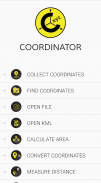
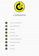
Coordinator-Collect Coordinate

Descrizione di Coordinator-Collect Coordinate
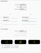
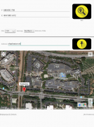
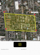
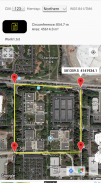
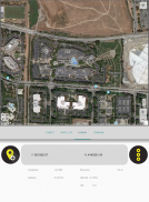
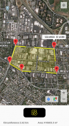
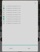
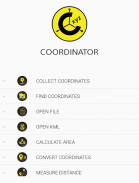
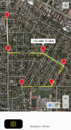
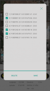
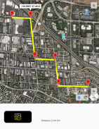
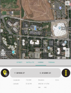
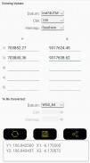
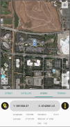
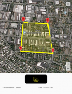
Utilizzando l'app Coordinator, puoi raccogliere i dati delle coordinate da terra su qualsiasi sistema di coordinate desideri, scegliendo tra i sistemi definiti. Puoi raccogliere le coordinate GPS. Puoi utilizzare l'app come localizzatore GPS. Puoi visualizzare i dati di una coordinata sulla mappa e anche cercare per indirizzo e vederlo sulla mappa. Puoi ottenere indicazioni per quel punto. Puoi cercare per longitudine/latitudine. È possibile convertire una coordinata esistente in un altro sistema di coordinate. Puoi farlo digitando le coordinate manualmente o aprendo un file XLSX che contiene le coordinate. È possibile visualizzare le misurazioni della circonferenza e dell'area di alcune coordinate aprendo il file creato in precedenza. Inoltre puoi misurare la distanza e l'area per alcune coordinate determinate manualmente sulla mappa. Puoi visualizzare un file KML sulla mappa. C'è anche uno strumento bussola. L'app Coordinator contiene diversi strumenti utili per le persone interessate a coordinate, mappe e sistemi di informazione geografica (GIS).
Tutte le funzionalità di cui sopra sono gratuite.
D'altra parte, se diventi un abbonato a Coordinator Pro, puoi beneficiare di molte funzionalità extra oltre a queste funzionalità. Con Coordinator Pro, gli abbonati possono utilizzare alcune funzionalità extra come le funzioni del database cloud (creazione di punti, linee e poligoni, condivisione dei livelli con i compagni di squadra, lavoro simultaneo con i compagni di squadra, lavoro offline e sincronizzazione, ecc.), esportazione in file KML ed Excel, interrogazione di elevazione e indirizzo e così via. È senza pubblicità.
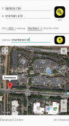
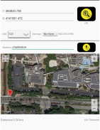
Oltre a longitudine/latitudine, gli abbonati possono scoprire il valore dell'altitudine di un punto sulla mappa. Puoi cercare per indirizzo e in modo da localizzarlo sulla mappa e conoscere il valore delle coordinate GPS (longitudine/latitudine o nord/est) di questo luogo. La funzione di localizzazione degli indirizzi funziona in base ai servizi di mappe ed è molto efficace.
Se sei un abbonato, puoi utilizzare l'app Web Coordinator. In modo che tu possa utilizzare le funzionalità del database cloud dell'app Coordinator sulla pagina Web sul tuo computer e monitorare i dati all'istante. È possibile visualizzare/tracciare e modificare i dati del database cloud sulla pagina Web. In questo modo puoi monitorare istantaneamente i movimenti di dati effettuati nell'app mobile sul campo, nel browser web del tuo computer.
All'app vengono aggiunti i sistemi di coordinate dei paesi in cui l'app è più scaricata.
Elenco attuale dei paesi e dei loro sistemi di coordinate definiti in questa app:
Mondo - GPS(WGS 84)
Mondiale - WGS 84 - 6 ̊ UTM
Stati Uniti - "NAD 1983 HARN State Plane Coordinate Systems (meters & feet)" e "Military Grid Reference System (MGRS)"
Algeria - "Nord Sahara 1959 / UTM 6 ̊ "
Azerbaigian - "Pulkovo 1942 / Gauss-Kruger 3 ̊" e "Pulkovo 1942 / CS63"
Bulgaria - "Pulkovo 1942(58) GK 6 ̊"
Germania - "DHDN/3 ̊ GK" e "ETRS89 UTM 6 ̊"
India - "Kalianpur 1975 / India" e "Kalianpur 1975 / UTM 6 ̊"
Indonesia - "Indonesia 1974 UTM 6 ̊" e "DGN 1995 Indonesia TM3 ̊"
Iran - "ED50(ED77) / UTM 6 ̊"
Iraq - "Nahrwan 1967 / UTM 6 ̊" e "ED50 / Iraq National Grid" e "Karbala 1979 / UTM 6 ̊"
Israele - "Palestine 1923/Palest. Grid" e "Palestine 1923/Israeli CS Grid" e "Israel 1993/Israeli TM Grid"
Libano - "Deir ez Zor / Levant Ster". e "Deir ez Zor / Siria Lambert"
Mauritania - "Mauritania 1999 / UTM 6 ̊"
Marocco - "Merchich / Nord Maroc" e "Merchich / Sud Maroc"
Paesi Bassi - "Amersfoort / RD New" e "Amersfoort / RD Old"
Palestina - "Palestine 1923/Palest. Grid" e "Palestine 1923/Israeli CS Grid" e "Israel 1993/Israeli TM Grid"
Filippine - "Luzon 1911 / Filippine" e "PRS92 / Filippine"
Romania - "Dealul Piscului 1930 / Stereo 33" e "Pulkovo 1942(58) / Stereo 70"
Russia - "Pulkovo 1942 / Gauss-Kruger 3 ̊"
Arabia Saudita - "Ain el Abd / UTM 6 ̊" e "Ain el Abd / Aramco Lambert"
Siria - "Deir ez Zor / Levante Ster". e "Deir ez Zor / Siria Lambert"
Turchia - "ITRF 96 - 3 ̊" e "ED 50 - 3 ̊" e "ITRF 96 - 6 ̊" e "ED 50 - 6 ̊"
Emirati Arabi Uniti - "Nahrwan 1967 / UTM"
Coordinator-Collect Coordinate - Versione 7.8.1
(12-06-2025)
Coordinator-Collect Coordinate - Informazioni APK
Versione APK: 7.8.1Pacchetto: com.suleymaner.coordinatorplusUltima versione di Coordinator-Collect Coordinate
Altre versioni


App nella stessa categoria


Potrebbe piacerti anche...


